
Drone Photography/Videography for Las Vegas Real Estate Listings

Why Aerial Photography Is Becoming an Important Part of Professional Real Estate Marketing
Imagine you are a buyer searching for a home in Las Vegas.
You find a beautiful property with professional interior photographs, a remodeled kitchen, spacious bedrooms, and an attractive backyard. Everything looks impressive, but there are several questions the photographs cannot answer.
How large is the lot? What does the entire backyard look like from above? How close is the home to the neighborhood park? Does the property really have mountain views? How is the home situated in relation to neighboring properties? Is there a golf course, lake, walking trail, or other desirable amenity nearby?
These are questions that traditional ground-level photography cannot always answer.
That is where professional drone photography and videography can make a substantial difference.
At EYECON Tours, we offer professional aerial photography and videography as complementary services to our real estate media packages. Drone photography provides a perspective that cannot be achieved from ground level, while drone videography adds movement and a cinematic quality that can make a listing presentation considerably more engaging.
Whether you are marketing a luxury estate in Henderson, a golf-course property in Summerlin, a home near Lake Las Vegas, a residential property in North Las Vegas, or a unique home in Boulder City, aerial imagery can help tell a more complete story about the property.
And just as importantly, EYECON Tours uses FAA Part 107-certificated drone operations, providing Realtors with a professional approach that accounts for federal aviation requirements, airspace restrictions, and safe flight planning.
The Importance of Professional Visual Marketing
The first impression most buyers receive of a property is not when they arrive for a showing.
It happens online.
Buyers browse listings, compare photographs, review amenities, examine floor plans, and watch videos before deciding which properties deserve more attention.
According to the National Association of REALTORS®' 2025 research, 81% of buyers considered listing photographs a very useful feature when searching for homes online.
That is an important reminder that professional photography is not simply documentation. It is one of the most influential elements of the property's initial marketing presentation.
Drone imagery enhances that presentation by showing aspects of a property that traditional photography may not capture adequately.
A professional exterior photograph shows how a home looks from the street.
A professional drone photograph can show how that home fits into its entire surroundings.
That additional context can help buyers understand the property's setting, outdoor features, orientation, neighborhood layout, and proximity to amenities.
Redfin's July 2026 article, 7 Reasons to Use Real Estate Drone Photography for Your Listing, identifies large lots, distinctive settings, scenic views, outdoor amenities, and surrounding neighborhoods among the situations where aerial photographs can be particularly valuable.
The key is not simply to obtain photographs from the air.
The goal is to show buyers something meaningful that they otherwise might not see.
1. Showcase the Entire Property, Not Just the House
A ground-level photograph is excellent for showing exterior architecture, landscaping, entryways, and individual features.
However, it can be difficult to communicate the full layout of the property when the camera is positioned at ground level.
Consider a home with:
A large backyard
A swimming pool and spa
A covered patio
An outdoor kitchen
A detached casita
An RV parking area
A six-car garage
A circular driveway
Multiple outdoor entertaining spaces
Traditional photographs can show these features individually.
An aerial photograph can show how they all fit together.
This is particularly important for larger residential properties because buyers may otherwise struggle to understand the scale and arrangement of the exterior improvements.
For example, a drone photograph taken at an appropriate height and angle can show the relationship between the primary residence, swimming pool, outdoor entertainment area, detached structures, and landscaped grounds in one image.
That can communicate more about the property's layout than several disconnected ground-level photographs.
EYECON Tours Recommendation: For homes with substantial outdoor improvements, combine an elevated three-quarter view of the property with a more overhead perspective that clearly demonstrates the exterior layout.
2. Make Pools, Spas, and Outdoor Living Areas Stand Out
In Southern Nevada, outdoor living spaces can be an important part of a home's appeal.
Many properties include features such as swimming pools, spas, waterfalls, fire pits, outdoor kitchens, pergolas, covered patios, artificial turf, putting greens, and landscaped entertaining areas.
Ground-level photography is excellent for showing the craftsmanship and details of these amenities.
However, when the outdoor space contains several features, an aerial perspective can show how they interact.
Imagine a backyard that includes a swimming pool, spa, covered seating area, outdoor kitchen, and putting green.
Individual photographs tell buyers what each feature looks like.
A drone photograph tells them how the backyard works as a complete outdoor environment.
Aerial imagery can also reveal whether the pool sits directly behind the home, how much usable yard remains, and how the outdoor spaces connect with the residence.
This can be especially valuable for luxury properties where outdoor living is a significant selling feature.
3. Capture Mountain, City, Lake, and Golf-Course Views
One of the strongest applications of drone photography in the Las Vegas Valley is documenting the surrounding landscape.
Southern Nevada offers a variety of settings that can be meaningful to potential buyers.
Depending on the property's actual location and visibility, these may include:
Red Rock Canyon and the Spring Mountains
Las Vegas Valley and city views
The Las Vegas Strip skyline
Lake Las Vegas
Nearby golf courses
Black Mountain
Desert and foothill scenery
Lake Mead-area scenery
Open land or natural desert surroundings
A ground-level photograph may show only a small portion of the view.
An elevated photograph can sometimes provide a better sense of the broader setting.
However, there is an important distinction.
A drone photograph should accurately represent the property's location and surroundings, not imply a view that buyers cannot actually enjoy from the property.
For example, a drone may be capable of flying high enough to photograph a landmark that is not visible from the backyard or any habitable room.
That image might be useful for illustrating the general location, but it should not be presented as though it represents the homeowner's actual view.
At EYECON Tours, aerial photography should enhance the presentation while preserving an honest depiction of the property and its location.
4. Show Neighborhoods and Community Amenities
Buyers are not simply purchasing a house.
They are also choosing a location and, in many cases, a lifestyle.
This is particularly true in master-planned communities, gated neighborhoods, golf communities, and amenity-rich residential developments.
Imagine marketing a home located near a community clubhouse, pool, park, tennis courts, or walking trails.
You can describe those amenities in the MLS.
You can include individual photographs.
But an appropriately composed drone photograph can also help buyers understand the relationship between the home and those amenities.
That can be valuable when marketing properties in areas such as Summerlin, Green Valley, Anthem, Seven Hills, Inspirada, Lake Las Vegas, and other Southern Nevada communities.
EYECON Tours' drone service specifically emphasizes aerial views of neighborhoods and the ability to identify nearby points of interest.
Highlight Nearby Points of Interest
Aerial photographs can also be used to identify nearby features when the information is accurate and relevant.
For example, a photograph might identify a nearby park, clubhouse, trail system, or other recognizable destination.
These points of interest can help prospective buyers understand what the surrounding area offers.
However, Realtors should be careful with proximity claims.
A nearby landmark visible in an aerial photograph does not necessarily mean it is within walking distance or directly accessible from the neighborhood. Distances, accessibility, school information, and community amenities should be verified before being advertised.
EYECON Tours Recommendation: If a community amenity is an important selling feature, include both an aerial photograph showing its location and a closer photograph showing the amenity itself.
5. Showcase Large Lots, Acreage, and Unusual Property Layouts
Some properties are difficult to describe accurately using traditional photography alone.
This is especially true when the property contains:
Acreage
Multiple buildings
Detached garages
Workshops
RV storage
Horse facilities
Large driveways
Unusual lot shapes
Extensive outdoor improvements
Multiple entrances
Large setbacks
Drone photography can be particularly useful for these properties.
For example, a ground-level photograph of a residence on a large lot might make the home look attractive but fail to communicate how much land surrounds it.
An aerial photograph can make the setting easier to understand.
The same applies to properties with detached buildings or substantial improvements located away from the main residence.
Rather than making buyers mentally assemble the property from a collection of individual photographs, the aerial perspective provides a broader visual explanation.
An Important Note About Property Boundaries
Aerial images can provide context, but they are not surveys.
If a Realtor wants property boundaries illustrated on an aerial photograph, the lines should be based on reliable parcel or survey information and clearly identified as approximate when appropriate.
Aerial boundary overlays should never be represented as a substitute for a professional survey or independently verified legal description.
6. Help Buyers Understand Privacy and Neighboring Properties
Privacy can be an important consideration for prospective buyers.
This is especially true for homes with swimming pools, large backyards, outdoor kitchens, rooftop decks, or extensive outdoor living areas.
Drone photographs can help buyers understand how the home sits in relation to neighboring properties.
An elevated view might show:
The distance between homes
Whether the backyard borders open land
The orientation of neighboring properties
How the home sits within the subdivision
The location of nearby streets
The presence of adjacent open spaces
This can be useful information for buyers who place a high value on privacy.
Of course, not every property has a privacy advantage.
Aerial photographs may reveal nearby homes, commercial properties, traffic corridors, or other conditions that are not apparent from ground-level photographs.
That is another reason to use drone imagery honestly and strategically.
The purpose should be to provide meaningful context, not conceal material features or misrepresent the surroundings.
Drone Photography vs. Drone Videography: What Is the Difference?
Although both services use an aerial platform, they serve different marketing purposes.
Drone Photography: High-Impact Aerial Still Images
Drone photography produces individual photographs that can be incorporated into the listing's image gallery and other marketing materials.
A professional aerial photograph can showcase the entire property, emphasize a backyard, illustrate the location, or provide a dramatic elevated perspective.
These images can be used in:
MLS listing galleries
Branded property websites
Unbranded property websites
Social media posts
Flyers
Brochures
Booklets
Email campaigns
Listing presentations
An advantage of drone photography is that buyers can study an image at their own pace.
They can examine the property layout, outdoor improvements, nearby streets, and surrounding features without the image moving.
For some listings, a single carefully composed aerial photograph may be one of the most informative images in the entire gallery.
Drone Videography: Movement, Scale, and a Cinematic Experience
Drone videography adds movement to the aerial perspective.
Rather than seeing one photograph, the viewer can watch a camera approach the property, reveal its architecture, move above outdoor amenities, or gradually show the surrounding neighborhood.
Common movements include:
The Approach: The camera slowly moves toward the home, introducing the property and its exterior appearance.
The Reveal: The camera rises or moves outward to reveal the backyard, surrounding landscape, or nearby amenities.
The Orbit: The camera moves around the property while maintaining the home as the subject, helping viewers understand its architecture and surroundings.
The Pullback: The camera gradually moves away from the home, revealing more of the neighborhood and setting.
The Overhead View: The camera looks downward to illustrate the relationship between the residence, driveway, yard, pool, and other improvements.
The best drone videos use smooth, purposeful movement.
A video does not need dramatic speed or aggressive camera motion to look impressive.
For real estate marketing, slow and controlled movements often provide a more professional result because they allow viewers to understand what they are seeing.
Drone Videography Is Especially Valuable for Social Media
One of the strongest reasons to order drone video is the ability to use it across multiple marketing channels.
A short aerial sequence can serve as the opening of a professional listing video.
It can also be incorporated into:
Instagram Reels
Facebook Reels
TikTok videos
YouTube Shorts
Horizontal YouTube property videos
Social media stories
Property website videos
Email marketing
For example, a Reel might begin with a smooth aerial approach toward the home.
The next segment could feature the front entrance, followed by interior HDR photographs or video clips, backyard features, and a closing image containing the Realtor's branding.
The result is a more complete property presentation than a standard slideshow of individual photographs.
This is particularly useful for luxury residences and homes with distinctive outdoor features.
But drone video can also benefit smaller homes when location, neighborhood amenities, or property context provides something meaningful to showcase.
When Is Drone Photography Worth the Investment?
Not every home needs the same level of media coverage.
A smaller residence on a standard lot may not require numerous aerial images if there are no meaningful surroundings or outdoor features to illustrate.
However, aerial photography may be especially valuable when one or more of the following conditions apply.
Property Type or Feature | How Drone Media Can Help |
Luxury homes | Shows architectural scale, outdoor amenities, and property setting. |
Homes with pools | Explains the full backyard layout and entertaining areas. |
Golf-course properties | Shows the property's relationship to the course and surrounding landscape. |
Lake Las Vegas properties | Illustrates relevant lake, neighborhood, or scenic context when visible. |
Mountain-view homes | Shows the surrounding landscape and property's orientation. |
Large lots and acreage | Communicates scale, land use, and detached improvements. |
Homes with casitas | Shows how separate structures relate to the main residence. |
RV garages and oversized garages | Highlights garage placement, driveway access, and property layout. |
Homes near community amenities | Illustrates the neighborhood and proximity to relevant features. |
Corner lots and cul-de-sac properties | Shows the property's street position and lot configuration. |
New construction | Shows the development setting and architectural design. |
Commercial properties | Provides context for buildings, access roads, parking, and surrounding areas. |
Vacant land | Shows terrain, access, nearby development, and general surroundings. |
The most useful question is not simply whether the property is expensive enough for drone photography.
It is:
Will an aerial photograph or video communicate something important that buyers would otherwise have difficulty understanding?
If the answer is yes, drone media deserves serious consideration.
When Drone Photography May Not Be Necessary
While aerial media can be valuable, ordering it automatically for every property is not always the most effective use of the marketing budget.
A conventional house on a very small lot may not have exterior features that justify a substantial aerial presentation.
A densely developed neighborhood may offer limited opportunities for attractive elevated photographs.
Nearby structures, trees, restricted airspace, or other limitations may also affect what can be captured safely.
In these situations, professional ground-level HDR photography may provide the most useful presentation.
Alternatively, a small number of aerial photographs may be sufficient.
At EYECON Tours, the objective should be to recommend media that actually benefits the listing, rather than simply adding services without a clear marketing purpose.
How Should Drone Photos Be Arranged in the MLS?
One important marketing decision is where aerial photographs should appear in the listing gallery.
Aerial photographs should complement the professional ground-level images rather than replace them.
For most residential properties, a strong sequence might begin with:
A professionally composed front exterior photograph.
An elevated drone image showing the home and property.
Aerial images highlighting significant outdoor features.
Interior photographs beginning with the strongest living spaces.
Additional bedrooms, bathrooms, and interior areas.
Backyard and outdoor living photography.
Supplemental neighborhood or community images.
The exact order depends on the property.
For a home with a spectacular pool and resort-style backyard, an aerial image may deserve one of the first few positions.
For a custom estate where the scale of the property is a primary selling point, an aerial photograph might even be the most effective hero image.
For a smaller home in a typical subdivision, the front exterior or best interior photograph may still be the strongest opening choice.
The goal is to select images based on what makes buyers interested—not simply because an aerial photograph looks dramatic.
Avoid overwhelming the MLS gallery with numerous photographs of rooftops from slightly different angles. A few meaningful aerial perspectives are usually more effective than a large collection of repetitive images.
When Is the Best Time to Capture Drone Photography?
Lighting plays a significant role in the quality of professional aerial media.
Southern Nevada offers abundant sunshine, but that does not mean every time of day produces equally attractive photographs.
Morning Photography
Morning light can provide softer shadows, particularly when the sun is still relatively low.
Depending on the property's orientation, the morning may provide attractive illumination across the front or rear elevation.
Afternoon Photography
Afternoon sessions may be useful when the architecture or backyard is best illuminated later in the day.
However, harsh overhead sunlight can create strong shadows and contrast, particularly during the summer.
Golden-Hour Photography
The period shortly after sunrise or before sunset can produce especially attractive light.
During this time, buildings and landscaping may appear warmer, while shadows become longer and more dimensional.
Golden-hour imagery can work particularly well for luxury properties, desert landscapes, and homes with mountain views.
Twilight Aerial Photography
Twilight can produce dramatic imagery when a home has attractive exterior lighting, illuminated pools, landscaping lights, and a distinctive setting.
However, drone flights at night or during applicable low-light periods require compliance with FAA rules, including appropriate pilot qualifications and anti-collision lighting, along with any required airspace authorizations.
Scheduling also depends on wind, visibility, airspace restrictions, and the specific property's location.
EYECON Tours Recommendation: Plan aerial photography around the property's actual orientation and strongest features rather than assuming one time of day is ideal for every home.
Why FAA Part 107 Certification Matters
This is one of the most important distinctions Realtors should understand when selecting a drone photographer.
EYECON Tours uses an FAA Part 107-certificated remote pilot for commercial drone operations.
The Federal Aviation Administration regulates commercial drone operations under Part 107 of the Federal Aviation Regulations.
The FAA requires commercial drone pilots operating under these rules to obtain a Remote Pilot Certificate and demonstrate knowledge of aviation regulations, airspace, operating procedures, and flight safety.
Certification is not simply a matter of purchasing a drone and learning how to operate its camera.
It involves understanding the responsibilities associated with operating an aircraft in the National Airspace System.
A Part 107-certificated remote pilot must understand requirements relating to:
Airspace classifications
Flight restrictions
Airport operations
Visual line-of-sight requirements
Aircraft registration
Remote identification
Weather and visibility
Operations near people
Operating limitations
Night operations
Safe flight procedures
The National Association of REALTORS® specifically advises agents hiring a drone service to verify that the operator has the appropriate FAA Remote Pilot Certificate.
NAR also recommends considering insurance coverage, copyright and usage rights, privacy, and operational liability when selecting a drone photographer.
For Realtors, this matters because the drone operator is providing a commercial service that must be conducted in accordance with aviation regulations.
Choosing EYECON Tours means choosing a media provider that recognizes professional drone operation as both a photography service and an aviation responsibility.
Why Airspace Restrictions Are Especially Important in Las Vegas
The Las Vegas Valley has several airports, active aviation corridors, and areas with potentially restricted or controlled airspace.
Depending on the property address, drone operations may be affected by airspace associated with:
Harry Reid International Airport
North Las Vegas Airport
Henderson Executive Airport
Other nearby aviation facilities
Temporary flight restrictions
Special-use or restricted airspace
Being FAA Part 107 certified does not automatically authorize a pilot to fly anywhere.
In controlled airspace, the operator may need to obtain FAA authorization before the flight.
The FAA provides an authorization system known as LAANC — Low Altitude Authorization and Notification Capability — that allows eligible pilots to request approval for certain flights in controlled airspace.
Some locations may require additional coordination, have strict altitude limits, or prohibit the intended operation.
This is why the exact property address matters.
A drone shoot that is straightforward in one part of Henderson may require different planning or authorization at another address.
At EYECON Tours, aerial services are subject to airspace availability, applicable permissions, weather, and safe operating conditions.
Part 107 certification is an important qualification, but every flight must still be evaluated individually.
Protecting Privacy and Maintaining Accurate Listing Photography
Professional drone photography should respect neighboring properties, privacy, and the accuracy of the listing presentation.
Aerial photography should never be used to suggest that a property includes land, features, or views that it does not actually possess.
Similarly, photographers and Realtors should be cautious when adding graphics, labels, or other enhancements to aerial images.
For example:
Property boundaries should be verified before being represented.
Distances to amenities should be accurate.
Nearby features should not be described as belonging to the community unless they actually do.
Public parks and private facilities should be identified correctly.
Neighboring homes should not be intentionally misrepresented.
Roof and structural conditions should not be altered to conceal defects.
Drone photography is a marketing tool, not a property survey or roof inspection.
The goal is to present the property attractively while accurately representing what buyers will experience.
Combining Drone Photography With Professional HDR Photography
At EYECON Tours, aerial imagery is designed to complement our professional HDR photography.
Our HDR process captures multiple exposures and combines them to produce bright, balanced photographs with clear windows, accurate colors, and detailed interior and exterior features.
We also do not limit our core HDR photography service to a predetermined gallery of 25 or 30 photographs.
We capture the images needed to cover the important features of the property.
Adding drone photography allows the marketing presentation to expand beyond the ground-level perspective.
Consider the combination:
Professional HDR Photography: Shows the architecture, rooms, finishes, landscaping, and property details.
Drone Photography: Shows the property layout, setting, outdoor improvements, and surrounding neighborhood.
Matterport 360° Virtual Tour: Allows buyers to explore the interior interactively.
Zillow 3D Home Tour: Provides another interactive experience with floor-plan functionality.
Drone Videography: Adds movement and cinematic aerial perspectives.
Media Marketing Kit: Gives the Realtor tools to distribute and repurpose that media across a complete marketing campaign.
Together, these services provide a much fuller picture of the property than still photography alone.
Drone Media Can Strengthen a Realtor's Listing Presentation
A professional aerial photograph can help market more than the property.
It can also help market the Realtor.
Imagine competing against several agents for a new listing.
One agent tells the seller they will take photographs and place the home into the MLS.
Another Realtor opens a previous listing on a tablet and shows:
Professional HDR Photography
Dramatic aerial property images
Smooth drone video
Matterport 360° Virtual Tour
Zillow 3D Home Tour
A branded property website
Social media marketing reels
Professional flyers and brochures
QR-code marketing
A complete Media Marketing Kit
The second presentation gives the seller tangible examples of the marketing services being proposed.
This is where a complete listing-media strategy can help Realtors demonstrate value.
Instead of simply promising to market the home aggressively, they can show what their previous marketing campaigns looked like.
Drone photography and videography become part of that professional portfolio.
And every completed listing can become another example used to attract future sellers.
Getting the Most Out of Drone Media After the Photo Shoot
One of the biggest mistakes Realtors can make is using drone media only once.
Aerial photographs and video clips can be repurposed repeatedly throughout a listing's marketing campaign.
For example:
Coming Soon: Create a teaser Reel with an aerial property reveal.
Just Listed: Include a compelling drone photograph in the announcement and property website.
Open House: Use a drone photograph as the background for an open-house promotion.
Property Feature Post: Highlight the pool, backyard, golf-course setting, or other significant amenity.
Price Adjustment: Create a fresh marketing graphic using a different aerial perspective.
Under Contract: Use a professional exterior aerial image in a status announcement.
Sold: Create a branded Sold graphic that also demonstrates your marketing capabilities to future sellers.
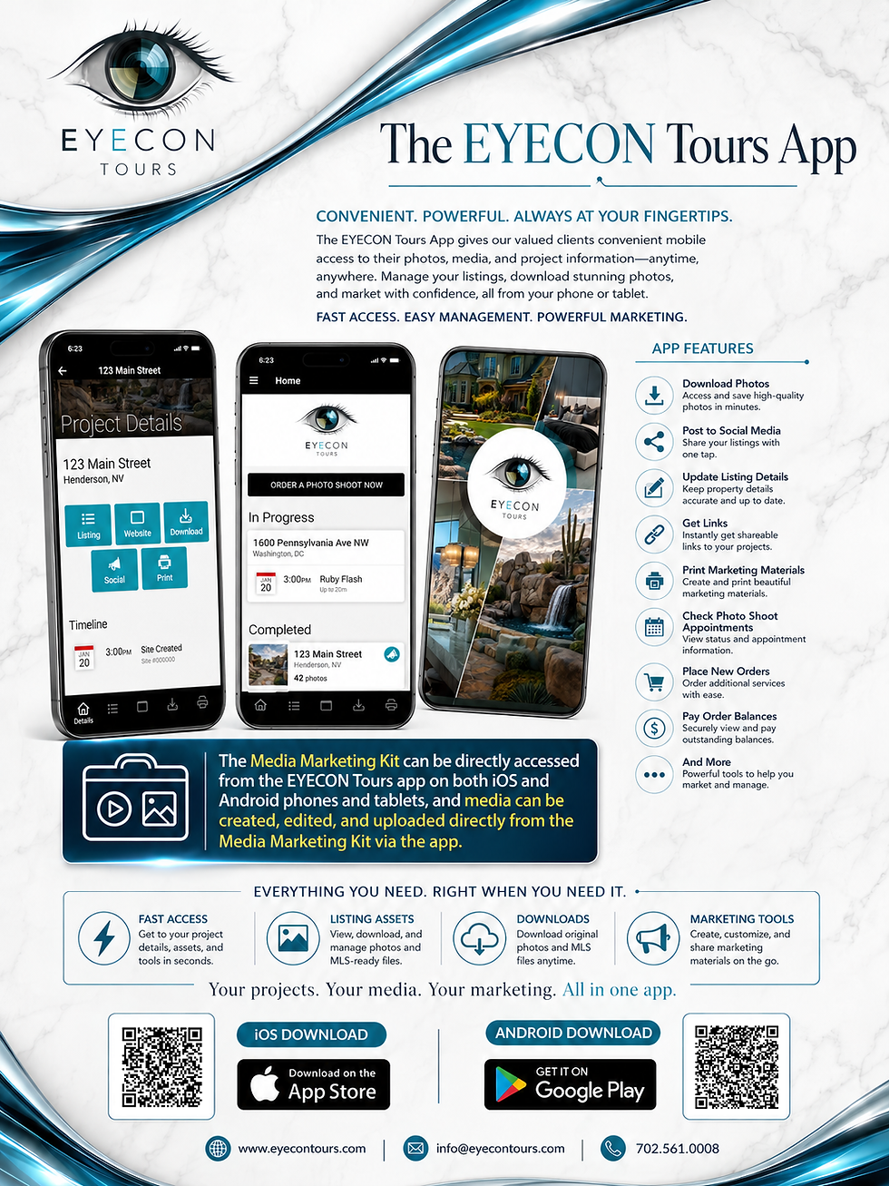
With the EYECON Tours Media Marketing Kit, Realtors can use delivered property media to create social media reels, posts, stories, slideshows, flyers, brochures, booklets, and branded or unbranded property websites.
And the Media Marketing Kit is included with every EYECON Tours package.
This is an important distinction.
A drone photograph should not simply be another file downloaded and forgotten.
It can become an asset that contributes to repeated marketing exposure throughout the listing process.
Drone Photography and the Property Website
Every EYECON Tours package includes access to a property website through the Media Marketing Kit.
That website can become the central destination for the property's marketing campaign.
Professional aerial photographs can be included alongside:
HDR interior and exterior photography
Virtual tours
Property descriptions
Floor plans, when available
Videos
Community information
Interactive maps
Realtor contact information
The website can then be shared through social media, email marketing, QR-coded flyers, brochures, and other promotional channels.
For example, an open-house visitor might receive a flyer featuring an impressive aerial photograph of the property.
They scan the QR code later that evening.
They return to the property website.
From there, they can examine the aerial images, review the interior photographs, explore the virtual tour, and contact the Realtor with questions.
That is how one professional drone shoot can support much more than an MLS photo gallery.
How Much Does Drone Photography and Videography Cost in Las Vegas?
EYECON Tours offers drone services as optional additions to its real estate media packages.
Our published a la carte drone pricing is:
Service | Price |
Drone Photography | $125 |
Drone Videography | $150 |
The two services are available separately because not every listing requires both.
Drone photography is useful when the Realtor needs still images for the MLS, website, social media, and printed marketing materials.
Drone videography is useful when the Realtor wants aerial motion footage for video marketing, property presentations, or social media reels.
For properties with substantial outdoor features, desirable surroundings, or a premium marketing strategy, combining both services can provide a more complete presentation.
Flight feasibility and any additional requirements should be confirmed when scheduling.
Which EYECON Tours Package Should You Choose?
EYECON Tours offers four primary listing-media packages: Bronze, Silver, Gold, and Platinum.
Drone photography and videography can be considered as complementary services depending on the listing's requirements.
Bronze Package
Includes professional HDR Photography and the Media Marketing Kit.
Adding drone photography can be particularly helpful when the property has a larger lot, unusual orientation, attractive backyard, or desirable neighborhood setting.
Silver Package
Includes the Bronze services plus a Zillow 3D Home Tour and its floor-plan functionality.
Adding drone media allows buyers to understand not only the home's interior layout but also its surrounding property and location.
Gold Package
Includes professional HDR Photography, Matterport 360° Virtual Tour, and the Media Marketing Kit.
Drone photography can provide exterior context that complements Matterport's detailed interior navigation.
Platinum Package
Includes professional HDR Photography, Matterport 360° Virtual Tour, Zillow 3D Home Tour, and the Media Marketing Kit.
Adding drone photography and videography creates an especially comprehensive marketing presentation, combining interior photography, multiple interactive tours, floor-plan functionality, and aerial perspectives.
For luxury properties or listings where location and outdoor amenities are major selling features, this can be an effective combination.
How to Prepare a Property for Drone Photography
Although drone photography takes place outside, preparation still matters.
Before the appointment, sellers and Realtors should consider:
Removing vehicles from driveways when possible.
Moving trash and recycling containers out of sight.
Cleaning the pool and spa.
Removing pool-cleaning equipment.
Straightening outdoor furniture.
Opening patio umbrellas when appropriate and safe.
Putting away hoses and gardening tools.
Cleaning patios and walkways.
Removing unnecessary toys and personal items.
Trimming or cleaning up landscaping.
Securing pets.
Making exterior areas accessible.
Informing the photographer about property boundaries and important features.
Identifying any community restrictions that may affect takeoff or landing.
For large properties, it may also be helpful to provide a list of features you want emphasized.
For example:
"Please make sure the drone shows the six-car garage, RV parking, outdoor kitchen, pool, rooftop deck, and relationship to the golf course."
That gives the photographer useful direction before the flight begins.
The better prepared the property is, the more time can be devoted to capturing meaningful aerial perspectives.
Frequently Asked Questions
Does Every Listing Need Drone Photography?
Not necessarily. Drone photography is most useful when it reveals meaningful information about the property, its lot, amenities, views, or surrounding location. Some smaller properties may benefit more from exceptional ground-level photography.
Can Drone Images Be Added to the MLS?
Generally, yes, subject to the MLS's current rules and the accuracy of the media. Drone still photographs can be incorporated into the property's image gallery, while drone video may be shared through appropriate tour, video, or marketing channels.
Can Drone Video Be Used on Instagram and YouTube?
Yes. Drone video can be incorporated into listing videos, Instagram Reels, Facebook Reels, TikTok content, YouTube Shorts, and traditional horizontal YouTube videos.
Editing and framing should be appropriate for the chosen platform.
Can a Drone Show the Property Boundaries?
A drone can provide an aerial perspective of the land, but it cannot independently establish legal property boundaries. Any boundary illustrations should be based on reliable documentation and identified appropriately.
Can a Drone Photograph a Property Near an Airport?
Sometimes, depending on the exact location, airspace classification, altitude restrictions, and required approvals. Being Part 107 certified does not automatically authorize flight in restricted or controlled airspace.
Can Drone Photography Replace Ground-Level Photography?
No. Drone photography is generally most effective as a supplement to professional ground-level photography. Interior and street-level exterior photographs remain essential to a complete real estate listing.
Does Drone Photography Guarantee a Faster Sale?
No photography service can guarantee that a property will sell faster or for a higher price.
Pricing, location, condition, market demand, competition, and the Realtor's broader marketing strategy all influence the outcome.
Drone photography can help make a listing more informative, visually compelling, and memorable, but it should be viewed as part of the overall marketing strategy rather than a guaranteed sales result.
Final Thoughts: A Better Perspective Can Create a Better Presentation
Professional real estate photography is about helping buyers understand a property and recognize its strongest features.
Sometimes those features are best shown from inside the home.
Sometimes they are best shown from the street.
And sometimes, the most informative view comes from above.
Drone photography can reveal the property's layout, outdoor amenities, lot configuration, scenic surroundings, and neighborhood context in ways traditional photography cannot.
Drone videography adds movement and provides opportunities to create cinematic listing presentations that work especially well on property websites, social media, and video platforms.
At EYECON Tours, these services are part of a larger approach to professional listing media.
We combine high-quality HDR Photography, Matterport 360° Virtual Tours, Zillow 3D Home Tours, floor plans, drone services, virtual enhancements, twilight photography, property websites, and the Media Marketing Kit to give Realtors a more complete marketing solution.
And with our FAA Part 107-certificated drone operations, Realtors can feel confident that commercial drone services are planned with the appropriate attention to aviation safety and regulatory requirements.
For the right property, drone photography and videography are not simply attractive extras.
They are opportunities to show buyers more, tell a stronger property story, and demonstrate the professional marketing capabilities of the Realtor.
Elevate Your Next Listing With EYECON Tours
If you are preparing to list a property in Las Vegas, Henderson, North Las Vegas, Boulder City, or the surrounding Southern Nevada area, consider whether professional aerial imagery could add something meaningful to your marketing campaign.
Whether you need a few carefully composed drone photographs, cinematic drone footage, or a complete listing-media package, EYECON Tours can help you select the services that best showcase the property.
One property. Multiple perspectives. A more complete marketing strategy.
Website: https://www.eyecontours.com
Drone Services: https://www.eyecontours.com/drone-services
Email: info@eyecontours.com
Phone: 702·561·0008
EYECON Tours — See More. Sell More.


Comments